Ward Pound Ridge Reservation, the largest park in Westchester County, was opened in 1938. Over thirty farms were acquired for the park, and old stone walls, which once marked the boundaries between the various farms, criss-cross the reservation. Most intersections are marked by numbered signs posted on trees. These numbers are shown on the park map and referred to in the description below....
Hike Description:
Ward Pound Ridge Reservation, the largest park in Westchester County, was opened in 1938. Over thirty farms were acquired for the park, and old stone walls, which once marked the boundaries between the various farms, criss-cross the reservation. Most intersections are marked by numbered signs posted on trees. These numbers are shown on the park map and referred to in the description below. Since the trail system in the park is complex, hikers should obtain a copy of the free park map before beginning the hike.
For most of the way, this hike follows the Rocks Trail – so named because it links six historic and scenic features, each of which has “Rock” as part of its name! This trail was constructed by volunteers in 2010 and, for much of its way, follows a footpath constructed by the volunteers (rather than old woods roads).
From the circle at the end of Michigan Road, bear right and follow a grassy road. Just beyond a gate, you’ll pass a kiosk on the right with a map of the trails. Just ahead, bear right at the fork (junction 70), following the red and green blazes, then bear left at junction 53, continuing to follow the Green Trail (the Red Trail and a branch of the Green Trail turn right here). The Green Trail climbs steadily on a woods road, then descends to junction 35 (the number is on the back of a tree and may not be immediately visible). Turn left here onto the Red Trail, but just ahead, turn right onto the Rocks Trail, marked with the letters “RT” on a white background. You will be following the Rocks Trail for the next four and one-half miles (with a side trip to Dancing Rock on a white-blazed trail).
The Rocks Trail proceeds uphill on a woods road through laurel thickets. In about half a mile, at junction 37, a white-blazed trail begins on the left. Turn left and follow this white trail uphill to Dancing Rock – a large flat rock where farmers used to dance to celebrate the conclusion of the harvest season. Continue to follow the white trail, which loops behind the rock, passing stone ruins, and descends to rejoin the Rocks Trail at junction 60.
Turn left and continue along the Rocks Trail, which climbs a little and crosses under power lines. It briefly parallels the power lines, then bears left. As it descends through the woods, it passes Bear Rock on the right. Bear Rock is named for a petroglyph, a carving in the shape of a bear, on the west side of the rock. After paralleling the power lines again, the trail reaches junction 39 and turns left. After crossing two stone walls, it reaches a junction with a yellow-blazed horse trail, maintained by the Bedford Riding Lanes Association (BRLA), which goes off to the right. Follow the Rocks Trail, which turns left and descends. At the base of the descent, turn right and cross a seasonally wet area on puncheon and rocks. After crossing two more stone walls, the Rocks Trail turns sharply left and parallels a stone wall, while a yellow-blazed BRLA trail continues ahead.
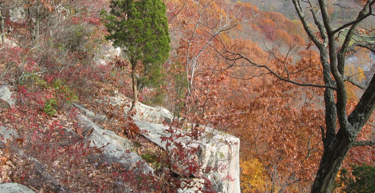
At the end of the stone wall, the Rocks Trail bears right and climbs to Spy Rock, with south-facing views through the trees. During the Revolutionary War, this rock ledge was used by the Americans to observe the movements of British troops. Unfortunately, the recent growth of vegetation limits the views from this location. Now descending, the Rocks Trail passes a ledge on the left, with more views. It continues down into gully known as Matey's Gulch, with impressive cliffs on the right, then climbs out of the gully and crosses a level area. It soon begins a steady descent, first gradually, then more steeply on a series of about 80 rock steps and continues through a mixed forest of fir and beech trees.
At the base of the descent, the Rocks Trail bears left and heads northeast, following a level woods road through a pretty valley. Just past a deer exclosure on the right, the Rocks Trail turns sharply right, leaving the woods road, and continues on a footpath. It briefly parallels the road, then begins to climb. After crossing an underground intermittent stream and an old stone wall with some cut stones, the trail climbs more steeply. It levels off, then continues on an undulating route along the side of the hill, with several rather steep ups and downs.
After briefly joining an old woods road, the Rocks Trail crosses an intermittent stream and climbs to pass beneath the power lines. Just beyond the power lines, it passes a huge boulder on the left, known as Castle Rock (visible behind the trees). The trail now follows a woods road to junction 59, where it turns right. Ahead, the woods road is a white-blazed trail.
The Rocks Trail crosses a wet area on puncheon, descends a little to cross an intermittent stream on rocks, then climbs steadily to reach a high point, where the trail crosses exposed rocks. It then descends a little and continues along the edge of the escarpment, with views to the right through the trees across the Stone Hill River valley. After passing junction 62, the Rocks Trail reaches Raven Rocks (junction 68) – a spectacular south-facing unobstructed overlook from a cliff (use caution, as there is a sharp drop here!). This view is the best on this hike, and a bench has been placed here, so you may wish to take a break and enjoy the view.
From Raven Rocks, the Rocks Trail continues ahead along the escarpment. It soon begins to descend, crossing an intermittent stream on puncheon. After briefly leveling off, the Rocks Trail turns left at junction 67 and begins to climb. It passes through dense mountain laurel thickets and reaches junction 58, where it turns right. After crossing two wet areas on puncheons, it reaches junction 49, where a white-blazed trail begins on the right. Continue ahead on the Rocks Trail, which climbs gradually and then levels off.
Immediately after passing junction 18 (where another white-blazed trail begins on the left), you’ll come to the Indian Rock Shelter (on the right). It is the last of the six “rock” features along the hike. Native Americans frequented this spot because the overhanging rocks offered protection from the rain. Continue ahead on the Rocks Trail, which crosses two streams on wooden bridges.
After crossing the second bridge, bear left, uphill, to reach junction 19, at an intersection with the Red and Yellow Trails. Here, the Rocks Trail turns left, but you should turn right onto the joint route of the Red and Yellow Trails, soon passing dramatic cliffs on the left. Continue to follow the Red and Yellow Trails along a wide woods road for about 1.25 miles, turning left at junction 12 and passing junctions 50 and 11, returning to the parking area where the hike began.
Publication: Submitted by Daniel Chazin on 03/03/2011 updated/verified on 06/15/2018


This loop hike follows the scenic Rocks Trail along the southern end of the reservation, passing several historic features and viewpoints.
41.248483, -73.595781
Westchester Co., NY
8 mi
5 hrs

Hike Checklist:
Whether you are going for a day hike or backpacking overnight, it is good practice to carry what we call The Hiking Essentials. These essentials will help you enjoy your outing more and will provide basic safety gear if needed. There may also be more essentials, depending on the season and your needs.
The Essentials
Hiking Shoes or Boots
Water - Two quarts per person is recommended in every season. Keep in mind that fluid loss is heightened in winter as well as summer. Don't put yourself in the position of having to end your hike early because you have run out of water.
Map - Know where you are and where you are going. Many of our hiking areas feature interconnecting network of trails. Use a waterproof/tear-resistant Tyvek Trail Conference map if available or enclose your map in a Ziplock plastic bag. If you have a mobile device, download Avenza’s free PDF Maps app and grab some GPS-enhanced Trail Conference maps (a backup Tyvek or paper version of the map is good to have just in case your batteries die or you don't have service). Check out some map-reading basics here.
Food - Snacks/lunch will keep you going as you burn energy walking or climbing. Nuts, seeds, and chocolate are favorites on the trail.
Sunscreen and insect repellent
Rain Gear and Extra Clothing - Rain happens. So does cold. Be prepared for changing weather. Avoid cotton--it traps water against your skin and is slow to dry. If you are wearing wet cotton and must return to your starting point, you risk getting chills that may lead to a dangerous hypothermia. Choose synthetic shirts, sweaters and/or vests and dress in layers for easy on and off.
Compass - A simple compass is all you need to orient you and your map to magnetic north.
Light - A flashlight or small, lightweight headlamp will be welcome gear if you find yourself still on the trail when darkness falls. Check the batteries before you start out and have extras in your pack.
First Aid Kit - Keep it simple, compact, and weatherproof. Know how to use the basic components.
Firestarter and Matches - In an emergency, you may need to keep yourself or someone else warm until help arrives. A firestarter (this could be as simple as leftover birthday candles that are kept inside a waterproof container) and matches (again, make sure to keep them in a waterproof container) could save a life.
Knife or Multi-tool - You may need to cut a piece of moleskin to put over a blister, repair a piece of broken equipment, or solve some other unexpected problem.
Emergency Numbers - Know the emergency numbers for the area you're going to and realize that in many locations--especially mountainous ones, your phone will not get reception.
Common Sense - Pay attention to your environment, your energy, and the condition of your companions. Has the weather turned rainy? Is daylight fading? Did you drink all your water? Did your companion fail to bring rain gear? Are you getting tired? Keep in mind that until you turn around you are (typically) only half-way to completing your hike--you must still get back to where you started from! (Exceptions are loop hikes.)
Check the weather forecast before you head out. Know the rules and regulations of the area.
The Leave No Trace Seven Principles
Plan Ahead and Prepare
- Know the regulations and special concerns for the area you'll visit.
- Prepare for extreme weather, hazards, and emergencies.
- Schedule your trip to avoid times of high use.
- Visit in small groups when possible. Consider splitting larger groups into smaller groups.
- Repackage food to minimize waste.
- Use a map and compass to eliminate the use of marking paint, rock cairns or flagging.
Travel and Camp on Durable Surfaces
- Durable surfaces include established trails and campsites, rock, gravel, dry grasses or snow.
- Protect riparian areas by camping at least 200 feet from lakes and streams.
- Good campsites are found, not made. Altering a site is not necessary.
- In popular areas:
- Concentrate use on existing trails and campsites.
- Walk single file in the middle of the trail, even when wet or muddy.
- Keep campsites small. Focus activity in areas where vegetation is absent.
- In pristine areas:
- Disperse use to prevent the creation of campsites and trails.
- Avoid places where impacts are just beginning.
- Pack it in, pack it out. Inspect your campsite and rest areas for trash or spilled foods. Pack out all trash, leftover food and litter.
- Deposit solid human waste in catholes dug 6 to 8 inches deep, at least 200 feet from water, camp and trails. Cover and disguise the cathole when finished.
- Pack out toilet paper and hygiene products.
- To wash yourself or your dishes, carry water 200 feet away from streams or lakes and use small amounts of biodegradable soap. Scatter strained dishwater.
- Preserve the past: examine, but do not touch cultural or historic structures and artifacts.
- Leave rocks, plants and other natural objects as you find them.
- Avoid introducing or transporting non-native species.
- Do not build structures, furniture, or dig trenches.
- Campfires can cause lasting impacts to the backcountry. Use a lightweight stove for cooking and enjoy a candle lantern for light.
- Where fires are permitted, use established fire rings, fire pans, or mound fires.
- Keep fires small. Only use sticks from the ground that can be broken by hand.
- Burn all wood and coals to ash, put out campfires completely, then scatter cool ashes.
- Observe wildlife from a distance. Do not follow or approach them.
- Never feed animals. Feeding wildlife damages their health, alters natural behaviors, and exposes them to predators and other dangers.
- Protect wildlife and your food by storing rations and trash securely.
- Control pets at all times, or leave them at home.
- Avoid wildlife during sensitive times: mating, nesting, raising young, or winter.
Be Considerate of Other Visitors
- Respect other visitors and protect the quality of their experience.
- Be courteous. Yield to other users on the trail.
- Step to the downhill side of the trail when encountering pack stock.
- Take breaks and camp away from trails and other visitors.
- Let nature's sounds prevail. Avoid loud voices and noises.
The Trail Conference is a 2015 Leave No Trace partner.
(c) Leave No Trace Center for Outdoor Ethics: www.LNT.org.
Directions to Trailhead :
Take I-684 North to Exit 6 (Cross River), which briefly joins the Saw Mill River Parkway, then exits to N.Y. Route 35. Turn right and follow Route 35 east for 3.7 miles to N.Y. Route 121. Turn right onto Route 121, cross a bridge over the Cross River, then immediately turn left and enter Ward Pound Ridge Reservation. Continue for 0.7 mile to the tollbooth (a parking fee is charged on weekends, daily in the summer). Make the first right beyond the tollbooth onto Michigan Road and continue for 0.7 mile to a parking area just before a turnaround circle at the end of the road (if this parking area is full, additional parking is available uphill to the left).
TRAIN TRANSPORT :
Not availableBUS TRANSPORT :
Not availableShare Your Experience

SUPPORT
 Support the trails with a donation!
Trail Conference volunteers maintain trails in this hike.
Trip Reports
rate experience January 21, 2017
Rocks Trail at Ward Pound Ridge Reservation
Fantastic day for a hike with my dogs. These trails are very well marked and the Rocks Trail hike is very dog friendly. Parking is $10.00.
January 05, 2012
Map link updated
<p> </p>
<p>Thanks for the info. The link is now updated.</p>
January 04, 2012
Map Link
<p>Map Link has apparently changed:</p>
<p>http://www.westchestergov.com/parks/pdfs/Maps/WPRezMap11x17.pdf</p>