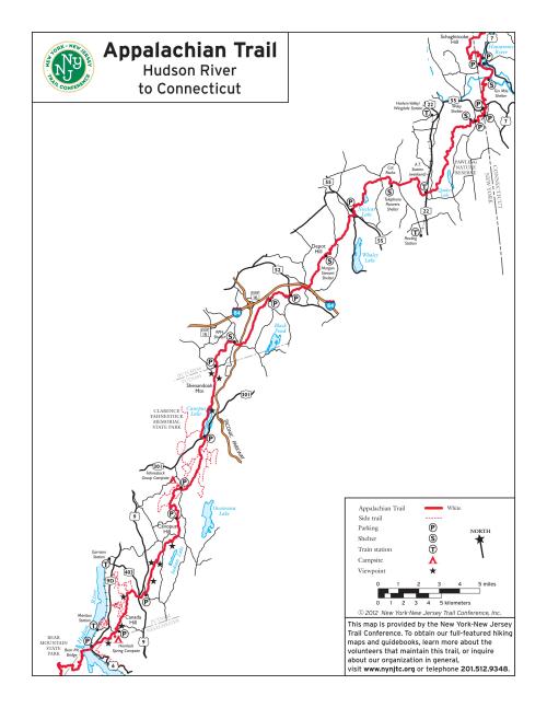
Appalachian Trail Map - Dutchess and Putnam provided by the Trail Conference
 This free map of the Appalachian Trail through Dutchess and Putnam counties is provided by the New York-New Jersey Trail Conference. It is also available as a free app map on your phone using the Avenza Maps app, so be sure to download it here.
The map is adapted in part from East Hudson Trails, a three-map set published by the Trail Conference featuring 150+ miles of marked trails and additional details like elevation contours (note that the section through Dutchess County is not covered by this map set). It is available in both waterproof/tear-resistant Tyvek print format as well as digital app map format for your phone.
This section of the Appalachian Trail is maintained by Trail Conference volunteers.
While this map may be free to use, our organization needs your support to help protect, build, and maintain more than 2,150 miles of trails throughout the region. Support the trails you love by:
- Purchasing maps and books
- Making a donation
- Volunteering your time
- Becoming a Trail Conference member
- Telling your friends and family where to find the best trail information!
Be sure to check out our selection of other free maps!
| Attachment | Size |
|---|---|
| 939.84 KB | |
| 929.25 KB |
